
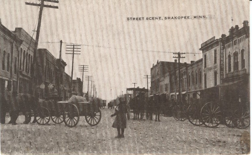
History of Scott County

Belle Plaine, 1902
Scott County, Minnesota is an area of 375 square miles located in the southwest corner of the Twin City metro area.

New Market, around 1900
The Minnesota River forms the northern border of the county. The broad river valley cuts though glacial sediment into some of the oldest rock known. Now primarily farm land, an oak savanna, a mixture of grass and clusters of trees grew parallel to the river valley. The savanna bordered the “big woods,” a hardwood forest that covered a majority of the state before it was logged in the mid-nineteenth century. Native American people occupied this area for last 10,000 years.

Jordan, 1945
The Dakota Nation inhabited southern Minnesota at the time Europeans began to enter the area to explore and later to engage in the fur trade. The Dakota are comprised of three major groups: Lakota, the western Dakota group; Nakota in the middle and Sentee on the east. These three groups are further divided into several bands. The area of Scott County was inhabited by two bands of the Sentee, the Mdewakanton and Wahpeton.

New Prague, around 1910
Dakota people farmed, hunted, and fished. The Dakota bands of the Shakopee, Eagle Head and Sand Creek had permanent villages in the area along the Minnesota River. Numerous roads linked these settlements and the Red River Valley in the North and Prairie Du Chein to the Southeast. These roads were later used by fur traders and settlers and came to be known as the “ox cart trails.”. Today, these roads are sections of highways 13, 169 and 101.

Prior Lake, 1908
The area of Scott County and much of southern Minnesota became available for European American re-settlement by two treaties signed at Mendota and Traverse des Sioux in 1851 and 1853, respectively.
Savage, 1943
Land speculators and settlers entered the area in droves staring in the mid-1850s. The Minnesota River and the ox cart trails being the primary transportation routes. The ethnic make-up of these settlers and speculators was broad. Yankees were the first to arrive, followed by groups of Germans Czechs and Scandinavians. Each group brought with them their own religions and traditions. Many became farmers.
Townsites sprang up as quickly as farms. Shakopee, the County Seat, began in 1851 as a trading post near the Dakota village of Chief Shakopee (or Shakpay). Townsites were established along transportation routes. Initially the Minnesota River was the predominant mode of transportation, later the railroad and highways.
Shakopee, around 1900
Today, urban sprawl and suburbanization are changing this primarily rural county. Industry has taken hold, and transportation issues play a primary factor in recent development. The Scott County Historical Society is working to preserve this rich and varied history by maintaining a resource center, exhibits and historic sites.