
Building a Town
Louisville was originally platted by French fur trader Louis LaCroix who established a trading post on the bank of the river, likely in 1850. In 1853, H. H. Spencer arrived from Louisville, Kentucky with his family. He envisioned a community in the northwest corner of the township thriving on steamboat travel and trade along the Minnesota River. Spencer soon began buying up lots. He built a home for his family, a grocery store, and a post office where he established himself as postmaster - and also offered free lots to other tradespeople who were willing to set up shop in the new community. Spencer then began working to recoup his investment, and make the town a financial success. Soon, he was advertising the prospects of Louisville in newspapers around the region.
This lengthy paragraph about Louisville was placed in the Minnesota Democratic Weekly on May 23, 1855:
“Located on the South Bank of the Minnesota River at the nearest point below the Little Rapids that is above high water, it is about 50 miles above St. Paul, by the river and 34 by land, and 10 or 12 miles by the river and 6 miles by land above Shakopee. Louisville is on a high rolling Prairie, with a number of springs of the best water and an abundance of good limestone in the vicinity. Louisville has a first rate landing for steamboats and is the landing place for that rich expansive country bordering and on the prairie and the big woods, and when the water is low for steamboats to cross the rapids, it is the place for the travellers to and from the Upper Minnesota country to leave the steamboat and take one when bound for st paul, being the principal traveled road from St Paul to St Peter, Fort Ridgley etc. Travellers to the upper country will find teams at Louisville and vicinity to convey them up to this country. Strangers looking for claims can get information of conveyances to a very rich country back unclaimed and well timbered and water interrupted with meadows and beautiful lakes abounding with fish. Louisville has a store and hotel in operation, and a blacksmith shop and several dwelling buildings. Persons looking for liquidations are also invited to visit this place where H. H. Spencer, one of the proprietors, will be found ready and willing to sell property at fair prices. Great induments will be offered to mechanics, merchants etc to settle her this season. The place is laid off on a liberal plan. Lots 50 by 150 foot. Streets and alleys wide, and liberal donations have been made by the proprietors in the way of public grounds for churches and school purposes. ”
Another example is this advertisement, published in the Daily Minnesotan Newspaper, November 1st, 1854:
“A new town is to be laid out on the Minnesota River, some 15 miles above Shakopee. A saw mill, warehouse, and a large hotel are to be erected this fall and early in the return of spring. Enterprising gentlemen from New York and Wisconsin have recently made purchases at the place, and will be on with their families in spring. A friend of ours in the section says we in St Paul can have no real conception of the rapidity with which this whole upper country is being filled up with immigrants. He estimated that no less than six thousand settlers have gone in above Shakopee since the opening of navigation last spring. This village is situated on the south side of the Minnesota at the foot of the little rapids. The town is going ahead- keeping pace with other thriving villages of the valley. Mr. H. H. Spencer is one of the proprietors and he has set up business on the spot. He took up by the Black Hawk yesterday several families to settle there, and lumber to build them houses. The land in the vicinity is excellent, and the country is rapidly filling up.”
As a result of this campaign, around 30 families moved to the settlement.

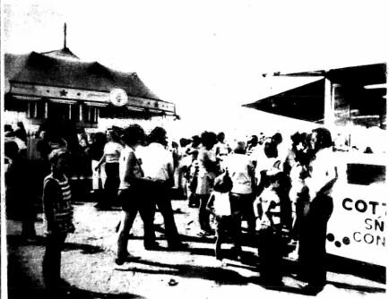
A section of the obituary for J.W. Sencerbox, printed in the Scott County Argus, January 16, 1896
Building up Business
In 1856, Spencer built a gristmill in Louisville. Later that year, two steam mills were constructed, one by Ezra Gibbs, and one by J. W. Sencerbox. Both mills were operated by steam, as the Minnesota River was too placid at the townsite to provide enough power to operate a mill. Neither mill was destined for a long life, however. Gibbs’ business was unprofitable from the onset, and closed within the year. Sencerbox’s mill only lasted four years, closing its doors in 1865.
In 1857, Spencer put down the funds to have a schoolhouse built in the town. A teacher, Hattie Kingsly, was brought on board. However, a 1937 article in the Jordan Independent describes the grim future of the schoolhouse thus: “An interest in education did not take in Louisville and from 1859 to 1863 the schoolhouse stood idle. Summer school was conducted in the next two years, and in winter of 1865-1866 Miss Belle Spencer held classes, but they were the last for Louisville”
Louisville never established a church, often a bedrock of early European American settlements in the area. Services were only held intermittently by circuit riders, usually in the home of H. H. Spencer.
The Decline of Louisville
In this period of history, rail could make or break a fledgling town. Trains brought goods and supplies, as well as convenient shipping lanes for local farmers and merchants. They also brought new people to settle and expand local communities.
Soon after Louisville was constructed, shipping and travel began to move from steamboats to the more convenient rail lines. Louisville’s death was foretold when the St Paul and Sioux City railroad was mapped out. It bypassed Louisville entirely, traveling from Shakopee to Jordan, and crossing with the Minneapolis and St Louis railroad line at a point called Merriam Junction. Farmers in the area began to take their goods and business elsewhere.
In spite of his hearty publicity campaign, Spencer’s interest in the town soon began to wane. He closed his original grocery store in 1859. By the end of the 1860s, the town was nearly deserted.

Railroads in Louisville Township. Photo from the Shakopee Valley News, September 16, 1987.